

Geography Tools
Explore 58 geography tools for country reference, live time-zone conversions, and geodetic calculations including UTM zones, grid convergence, and polygon area.
| Tool | Category | Description | Action |
|---|---|---|---|
|
Area By Coordinates
Calculates the area of a polygon defined by a list of coo...
|
Geography Tools | Calculates the area of a polygon defined by a list of coordinate pairs using the Shoela... | Open |
|
Argentina Country Facts
Quick-reference fact sheet for Argentina — capital, popul...
|
Geography Tools | Quick-reference fact sheet for Argentina — capital, population, area, official language... | Open |
|
Argentina Time Zones Overview
Reference page showing all time zones used in Argentina (...
|
Geography Tools | Reference page showing all time zones used in Argentina (ART, UTC-3) with a live clock ... | Open |
|
Bangladesh Country Facts
Quick-reference fact sheet for Bangladesh — capital, popu...
|
Geography Tools | Quick-reference fact sheet for Bangladesh — capital, population, area, official languag... | Open |
|
Bangladesh Time Zones Overview
Reference page for Bangladesh Standard Time (BST, UTC+6),...
|
Geography Tools | Reference page for Bangladesh Standard Time (BST, UTC+6), with a live clock, UTC conver... | Open |
|
Centroid of Polygon Calculator
Computes the geometric centroid (center of mass) of a pol...
|
Geography Tools | Computes the geometric centroid (center of mass) of a polygon from a list of (x, y) ver... | Open |
|
Current Time in Dhaka
Displays the current local time in Dhaka, Bangladesh (UTC...
|
Geography Tools | Displays the current local time in Dhaka, Bangladesh (UTC+6), with a live clock and con... | Open |
|
Egypt Country Facts
Reference page with key facts about Egypt: capital, popul...
|
Geography Tools | Reference page with key facts about Egypt: capital, population, area, currency, languag... | Open |
|
Egypt Time Zones Overview
Reference page showing Egypt's current EET or EEST offset...
|
Geography Tools | Reference page showing Egypt's current EET or EEST offset, local time, DST history, and... | Open |
|
Geoid Height Calculator
Estimates geoid undulation from NGA EGM96 values sampled ...
|
Geography Tools | Estimates geoid undulation from NGA EGM96 values sampled every 5°, or uses an N you sup... | Open |
|
Grade Percentage Survey Calculator
Convert surveying grade percentage to degrees and ratio, ...
|
Geography Tools | Convert surveying grade percentage to degrees and ratio, and vice versa, for slope and ... | Open |
|
Grid Convergence Calculator
Calculates the grid convergence angle (meridian convergen...
|
Geography Tools | Calculates the grid convergence angle (meridian convergence) between true north and UTM... | Open |
|
Indonesia Country Facts
A reference card and quick-facts tool for Indonesia — dis...
|
Geography Tools | A reference card and quick-facts tool for Indonesia — displays key stats (area, populat... | Open |
|
Indonesia Time Zones
Display Indonesia's three time zones (WIB UTC+7, WITA UTC...
|
Geography Tools | Display Indonesia's three time zones (WIB UTC+7, WITA UTC+8, WIT UTC+9) with live curre... | Open |
|
Italy Country Facts
Quick-reference fact sheet for Italy — capital, populatio...
|
Geography Tools | Quick-reference fact sheet for Italy — capital, population, area, official language, cu... | Open |
|
Italy Time Zones Overview
Shows the current time in Italy (CET/CEST), explains Ital...
|
Geography Tools | Shows the current time in Italy (CET/CEST), explains Italy's single time zone, and prov... | Open |
|
Malaysia Country Facts
A reference card and quick-facts tool for Malaysia — disp...
|
Geography Tools | A reference card and quick-facts tool for Malaysia — displays key stats (area, populati... | Open |
|
Malaysia Time Zones Overview
Overview of Malaysia's single time zone (MYT, UTC+8) with...
|
Geography Tools | Overview of Malaysia's single time zone (MYT, UTC+8) with current local time and city r... | Open |
|
Map Distance Calculator
Converts between map distance and real-world distance giv...
|
Geography Tools | Converts between map distance and real-world distance given a map scale. Supports metri... | Open |
|
Map Scale Calculator
Calculate real-world distance from a map measurement and ...
|
Geography Tools | Calculate real-world distance from a map measurement and scale ratio, or find the map s... | Open |
|
Mexico Country Facts
Quick-reference fact sheet for Mexico — capital, populati...
|
Geography Tools | Quick-reference fact sheet for Mexico — capital, population, area, official language, c... | Open |
|
Mexico Time Zones Overview
Shows current local times across Mexico’s Central, Mounta...
|
Geography Tools | Shows current local times across Mexico’s Central, Mountain, Pacific-border, and Easter... | Open |
|
Netherlands Country Facts
Quick-reference fact sheet for the Netherlands — capital,...
|
Geography Tools | Quick-reference fact sheet for the Netherlands — capital, population, area, official la... | Open |
|
Netherlands Time Zones Overview
Shows current local time across the Netherlands and its o...
|
Geography Tools | Shows current local time across the Netherlands and its overseas territories (Amsterdam... | Open |
|
New Zealand Country Facts
Quick-reference fact sheet for New Zealand — capital, pop...
|
Geography Tools | Quick-reference fact sheet for New Zealand — capital, population, area, official langua... | Open |
|
New Zealand Time Zones Overview
Reference page showing New Zealand's time zones (NZST/NZD...
|
Geography Tools | Reference page showing New Zealand's time zones (NZST/NZDT) with live clocks for Auckla... | Open |
|
Nigeria Country Facts
A reference card and quick-facts tool for Nigeria — displ...
|
Geography Tools | A reference card and quick-facts tool for Nigeria — displays key stats (area, populatio... | Open |
|
Nigeria Time Zones Overview
Display current time in Nigeria (WAT, UTC+1), show major ...
|
Geography Tools | Display current time in Nigeria (WAT, UTC+1), show major Nigerian cities with their cur... | Open |
|
Norway Country Facts
Quick-reference fact sheet for Norway — capital, populati...
|
Geography Tools | Quick-reference fact sheet for Norway — capital, population, area, official language, c... | Open |
|
Norway Time Zones Overview
Shows current local time in Norway (CET/CEST), UTC offset...
|
Geography Tools | Shows current local time in Norway (CET/CEST), UTC offset, DST schedule, and a world ci... | Open |
|
Pakistan Country Facts
Key facts, statistics, and data about Pakistan — capital,...
|
Geography Tools | Key facts, statistics, and data about Pakistan — capital, population, area, language, c... | Open |
|
Pakistan Time Zones Overview
Reference page for Pakistan Standard Time (PKT, UTC+5), w...
|
Geography Tools | Reference page for Pakistan Standard Time (PKT, UTC+5), with a live clock and compariso... | Open |
|
Perimeter by Coordinates Calculator
Finds the perimeter of a polygon, triangle or rectangle f...
|
Geography Tools | Finds the perimeter of a polygon, triangle or rectangle from its vertex coordinates wit... | Open |
|
Philippines Country Facts
A reference card and quick-facts tool for the Philippines...
|
Geography Tools | A reference card and quick-facts tool for the Philippines — displays key stats (area, p... | Open |
|
Philippines Time Zones Overview
Shows current time in the Philippines (PST, UTC+8), lists...
|
Geography Tools | Shows current time in the Philippines (PST, UTC+8), lists major cities with local clock... | Open |
|
Poland Country Facts
Quick-reference fact card for Poland — capital, populatio...
|
Geography Tools | Quick-reference fact card for Poland — capital, population, area, currency, language, c... | Open |
|
Poland Time Zones Overview
Shows current local time in Poland (CET/CEST), UTC offset...
|
Geography Tools | Shows current local time in Poland (CET/CEST), UTC offset, DST schedule, and a world ci... | Open |
|
Russia Time Zones Overview
Interactive reference showing all 11 Russian time zones w...
|
Geography Tools | Interactive reference showing all 11 Russian time zones with current local times, UTC o... | Open |
|
Saudi Arabia Country Facts
Reference page with key facts about Saudi Arabia: capital...
|
Geography Tools | Reference page with key facts about Saudi Arabia: capital, population, area, currency, ... | Open |
|
Saudi Arabia Time Zones Overview
Reference page for Saudi Arabia Standard Time (AST, UTC+3...
|
Geography Tools | Reference page for Saudi Arabia Standard Time (AST, UTC+3) with current time display an... | Open |
|
Singapore Country Facts
A reference card and quick-facts tool for Singapore — dis...
|
Geography Tools | A reference card and quick-facts tool for Singapore — displays key stats (area, populat... | Open |
|
Singapore Time Zones Overview
Shows Singapore's single time zone (SGT, UTC+8), current ...
|
Geography Tools | Shows Singapore's single time zone (SGT, UTC+8), current local time, and a world-clock ... | Open |
|
South Africa Country Facts
Reference page with key facts about South Africa: capital...
|
Geography Tools | Reference page with key facts about South Africa: capitals, population, area, currency,... | Open |
|
South Korea Country Facts
A reference card with key facts about South Korea — capit...
|
Geography Tools | A reference card with key facts about South Korea — capital, population, area, currency... | Open |
|
South Korea Time Zones Overview
Displays current time in South Korea (KST, UTC+9) and con...
|
Geography Tools | Displays current time in South Korea (KST, UTC+9) and converts between KST and other ma... | Open |
|
Spain Country Facts
Quick-reference fact card for Spain covering capital, pop...
|
Geography Tools | Quick-reference fact card for Spain covering capital, population, area, currency, langu... | Open |
|
Spain Time Zones Overview
Shows current local time in Spain's two time zones (CET/C...
|
Geography Tools | Shows current local time in Spain's two time zones (CET/CEST for mainland and Balearic ... | Open |
|
Sweden Country Facts
Quick-reference fact sheet for Sweden — capital, populati...
|
Geography Tools | Quick-reference fact sheet for Sweden — capital, population, area, official language, c... | Open |
Most popular in Geography Tools
Three Practical Workflows in Digital Geography
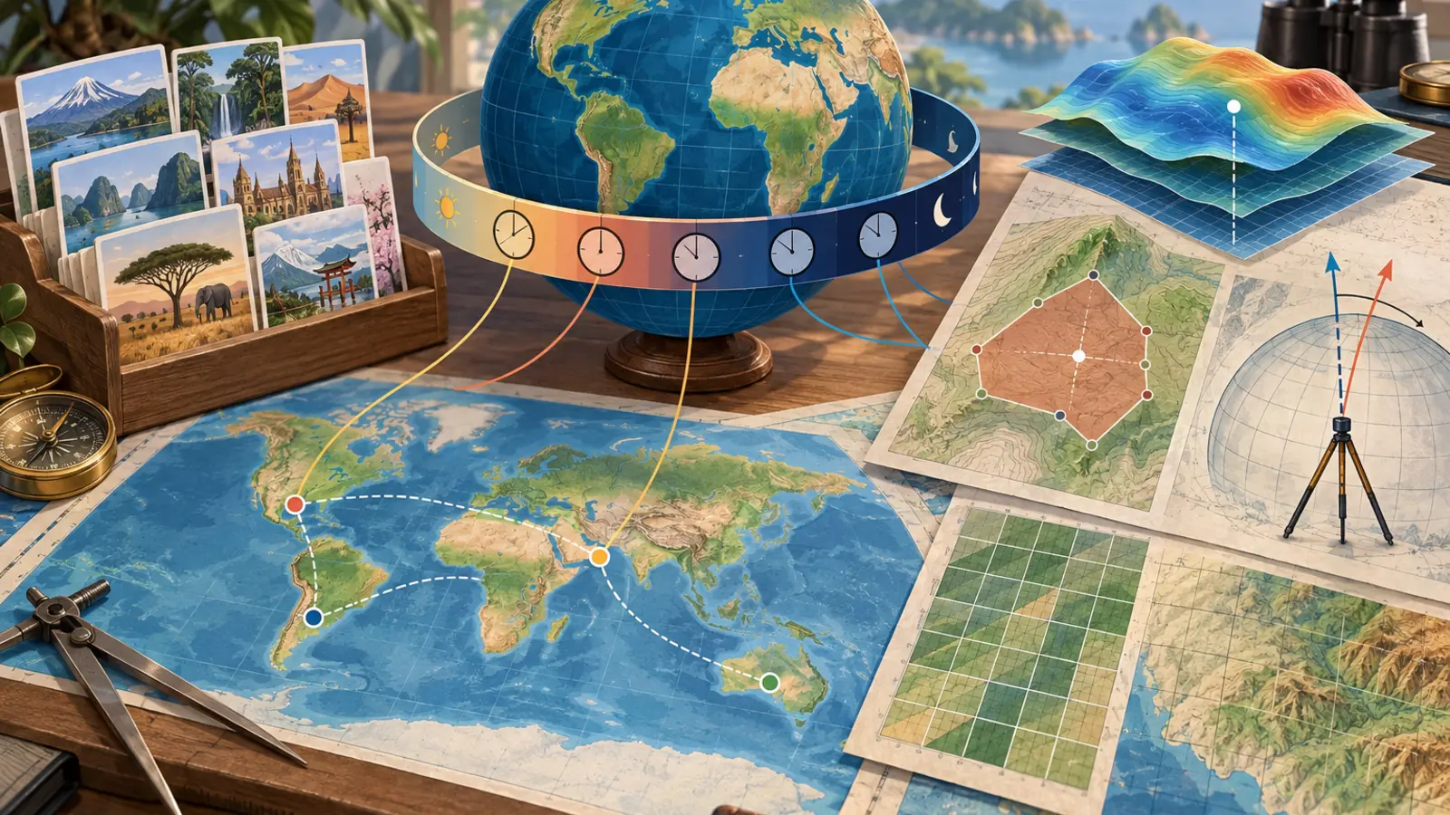
Working with geographic data generally involves three separate requirements: confirming baseline geopolitical data, coordinating schedules across international time zones, and performing cartographic or geodetic math. This collection of 58 tools addresses these distinct tasks directly:
- Geopolitical Reference Profiles: Rapid retrieval of official capitals, land area, populations, currencies, and administrative boundaries without sorting through sprawling encyclopedic articles.
- Time-Zone and Offset Operations: Real-time conversion between international hubs, monitoring daylight saving shifts, and managing fragmented regional time standards.
- Cartographic and Geodetic Computation: Evaluating map scale ratios, finding Universal Transverse Mercator (UTM) zones, calculating polygon boundary areas, and computing geoid undulations or grid convergence angles.
Understanding which calculation model applies to your project ensures that reference lookups remain fast while technical engineering tasks respect mathematical boundaries.
Geopolitical Fact Sheets: Baseline Metrics and Data Freshness
National fact sheets provide structured summaries for academic papers, logistical briefings, and international business overviews. Instead of uncurated web pages with shifting layouts, each sheet standardizes administrative, economic, and territorial indicators.
For European nations, examine the profiles for Italy Country Facts, Netherlands Country Facts, Norway Country Facts, Poland Country Facts, Spain Country Facts, and Sweden Country Facts to compare sovereign territories, administrative systems, and European Union relationships.
For East and Southeast Asian studies, reference sheets provide structured geographic insights for Indonesia Country Facts, Malaysia Country Facts, Philippines Country Facts, Singapore Country Facts, South Korea Country Facts, Thailand Country Facts, and Vietnam Country Facts.
South Asian profiles include Bangladesh Country Facts and Pakistan Country Facts. Middle Eastern reference profiles cover Egypt Country Facts, Saudi Arabia Country Facts, Turkey Country Facts, and UAE Country Facts. African and Latin American profiles feature South Africa Country Facts, Nigeria Country Facts, Argentina Country Facts, and Mexico Country Facts, alongside Oceania coverage in New Zealand Country Facts.
Data Freshness and Demographic Caveats
Static geographic facts—such as total surface land area in square kilometers, primary border neighbors, and official capital cities—remain stable over decades unless formal administrative reorganizations occur. In contrast, demographic metrics like total population counts and economic indicators such as gross domestic product (GDP) represent census approximations and agency estimates from organizations like the United Nations and the World Bank. When preparing legal filings or economic research, verify these metrics against current statistical agency releases.
Global Time Zones: Offsets, Local Rules, and Daylight Shifts
Scheduling meetings, international travel, and remote server tasks requires evaluating how local jurisdictions define their standard offsets from Coordinated Universal Time (UTC). Many countries have moved away from seasonal clock changes entirely, while others maintain complex regional schedules.
Single-Zone Uniform Offsets Without Seasonal Changes
Countries operating on fixed, year-round standard offsets simplify scheduling because their difference relative to UTC never alters:
- West Africa Time (WAT, UTC+1): Used uniformly in Nigeria. You can track this clock using the Nigeria Time Zones Overview.
- Arabia Standard Time (AST, UTC+3): Observed year-round in Saudi Arabia via the Saudi Arabia Time Zones Overview.
- Turkey Time (TRT, UTC+3): Permanently established nationwide since September 2016, covered by the Turkey Time Zones Overview.
- Gulf Standard Time (GST, UTC+4): Observed across all seven Emirates, accessible via the UAE Time Zones Overview.
- Pakistan Standard Time (PKT, UTC+5): Fixed throughout all provinces, monitored in the Pakistan Time Zones Overview.
- Bangladesh Standard Time (BST, UTC+6): Unchanging across the nation, referenced via the Bangladesh Time Zones Overview or city-specific Current Time in Dhaka.
- Indochina Time (ICT, UTC+7): Kept consistently by Thailand and Vietnam, monitored through the Thailand Time Zones Overview and Vietnam Time Zones Overview.
- Singapore and Malaysia (UTC+8): Both nations maintain a uniform offset year-round, monitored through the Singapore Time Zones Overview and Malaysia Time Zones Overview. Similarly, Philippine Standard Time is tracked via the Philippines Time Zones Overview.
- Korea Standard Time (KST, UTC+9): Observed uniformly without daylight adjustments, tracked in the South Korea Time Zones Overview.
- Argentina Time (ART, UTC-3): Maintained without daylight saving time since 2009 across all provinces, available in the Argentina Time Zones Overview.
European Daylight Saving Time Harmonization
Continental European nations adhere to European Union daylight saving directives, advancing clocks by one hour on the last Sunday of March and returning on the last Sunday of October. During standard winter time, they operate on Central European Time (CET, UTC+1), switching to Central European Summer Time (CEST, UTC+2) during summer. You can verify active offsets and scheduled transition dates using:
- Italy Time Zones Overview
- Norway Time Zones Overview
- Poland Time Zones Overview
- Sweden Time Zones Overview
Multi-Zone Jurisdictions and Regional Exceptions
Several nations span multiple geographic intervals or govern territories with distinct time rules:
- Spain: Mainland Spain and the Balearic Islands follow CET/CEST, whereas the Canary Islands maintain Western European Time (WET, UTC+0) and Western European Summer Time (WEST, UTC+1), remaining one hour behind the mainland. Check these concurrent offsets with the Spain Time Zones Overview.
- The Netherlands: European territory observes CET/CEST, while the Caribbean municipalities and constituent nations (such as Aruba, Curaçao, and Sint Maarten) stay permanently on Atlantic Standard Time (AST, UTC-4). Evaluate the 5- to 6-hour differential using the Netherlands Time Zones Overview.
- Indonesia: Spanning three distinct standard zones—Western Indonesia Time (WIB, UTC+7), Central Indonesia Time (WITA, UTC+8), and Eastern Indonesia Time (WIT, UTC+9)—without daylight saving. Compare these intervals using the Indonesia Time Zones tool.
- Mexico: Governed by the national Time Zones Law of 2022, standard time applies across the vast majority of central and southern states (CST, UTC-6 year-round), while northern border municipalities and Baja California maintain daylight saving aligned with adjacent United States borders. Track these regional variations via the Mexico Time Zones Overview.
- Egypt: Reinstated daylight saving rules in 2023, shifting between Eastern European Time (EET, UTC+2) and Eastern European Summer Time (EEST, UTC+3), documented in the Egypt Time Zones Overview.
- New Zealand: Observes New Zealand Standard Time (NZST, UTC+12) and New Zealand Daylight Time (NZDT, UTC+13), while the Chatham Islands maintain an independent 45-minute forward offset (CHAST UTC+12:45 / CHADT UTC+13:45). Inspect both schedules in the New Zealand Time Zones Overview.
- Russia: Spans 11 contiguous zones from Kaliningrad (UTC+2) to Kamchatka (UTC+12). Moscow Time (MSK, UTC+3) acts as the operational baseline for nationwide transportation systems. Examine all 11 zones simultaneously using the Russia Time Zones Overview.
Map Scale, Distance, and Elevation Calculations
Working with physical cartography and route measurements requires translating measured page distances into real-world units.
Working with Map Distance and Scale
A representative fraction expresses the ratio between distance measured on a paper or digital map and corresponding ground distance. For example, a 1:24,000 USGS topographic quadrangle means 1 unit on the map represents 24,000 identical units on Earth.
Use the Map Distance Calculator and Map Scale Calculator to perform direct conversions across units:
- Finding Real-World Distance: If a measured route on a 1:50,000 topographic map spans 7.4 cm, the ground distance is 7.4 cm × 50,000 = 370,000 cm = 3,700 meters (3.7 km).
- Determining Scale Ratio: If a surveyed boundary fence known to be exactly 1.5 km (150,000 cm) appears as 3.0 cm on an aerial photograph, the scale ratio is 150,000 / 3.0 = 50,000, establishing a 1:50,000 scale.
Surveying Grade and Slope Ratios
Civil engineering, road grading, and trail analysis express incline through percentages, angular degrees, or run-over-rise ratios. The Grade Percentage Survey Calculator translates between these formats:
- Grade Percentage: Defined as (Rise / Run) × 100. A vertical rise of 6 meters over a horizontal run of 100 meters represents a 6% grade.
- Angular Incline: Derived by calculating the arctangent: arctan(6 / 100) ≈ 3.43 degrees.
- Ratio Representation: Expressed as 1 : (Run / Rise), yielding 1:16.67.
Planar Coordinate Geometry: Area, Perimeter, and Centroid
When working with local boundary surveys, land parcel plots, or site plan coordinate tables, standard planar formulas provide quick geometric checks.
The Shoelace Formula for Polygon Area
The Area By Coordinates tool implements Gauss's area formula (the Shoelace formula). Given an ordered series of vertices (x1, y1), (x2, y2), ..., (xn, yn), the signed area is calculated as:
Area = 0.5 × |(x1·y2 + x2·y3 + ... + xn·y1) - (y1·x2 + y2·x3 + ... + yn·x1)|
For instance, consider a simple four-point parcel with coordinates (0, 0), (0, 40), (30, 40), and (30, 0) in meters:
- Sum 1: (0×40) + (0×40) + (30×0) + (30×0) = 0
- Sum 2: (0×0) + (40×30) + (40×30) + (0×0) = 2,400
- Difference: |0 - 2,400| = 2,400
- Area: 0.5 × 2,400 = 1,200 square meters.
Important limitation: When entering latitude and longitude decimal degrees into a planar Shoelace calculation, the formula yields square degrees. Converting square degrees to square kilometers using a single multiplier introduces distortion as latitude increases, because meridians converge toward the poles. Planar calculations are accurate only for small localized extents or projected Cartesian coordinates (such as UTM eastings and northings).
Boundary Perimeter from Coordinate Lists
The Perimeter by Coordinates calculator computes the total boundary length of a polygon by applying the Euclidean distance formula between each sequential pair of vertices and closing back to the initial point:
Segment Length = √((x2 - x1)² + (y2 - y1)²)
Like planar area calculations, Euclidean perimeter evaluations on geographic coordinates (degrees) assume a flat Cartesian grid. They do not account for ellipsoidal curvature or geodesic arcs over long regional distances.
Geometric Polygon Centroid
Finding the balancing center or geographic center of mass of a polygon is evaluated by the Centroid of Polygon Calculator. Using the signed polygon area (A) obtained from the Shoelace formula, the coordinates of the centroid (Cx, Cy) are calculated using the standard weighted vertex summation:
- Cx = (1 / (6·A)) × ∑ ((xi + xi+1) × (xi·yi+1 - xi+1·yi))
- Cy = (1 / (6·A)) × ∑ ((yi + yi+1) × (xi·yi+1 - xi+1·yi))
This mathematical centroid applies strictly to non-self-intersecting, closed polygons. It reflects the geometric center of mass of a planar shape, which differs from geographic points of minimum aggregate travel or population-weighted centers.
Geodetic and Projection Tools: UTM, Convergence, and Geoid Undulation
Projecting Earth's curved ellipsoidal surface onto a flat planar coordinate system introduces spatial distortions that require specific mathematical corrections.
Universal Transverse Mercator (UTM) Zone Identification
The UTM projection system divides the globe into 60 longitudinal zones, each 6 degrees wide, numbered 1 through 60 eastward from the 180th meridian. Each zone has a designated Central Meridian where scale distortion is minimized.
Use the UTM Zone Finder to translate decimal latitude and longitude coordinates into the correct UTM zone and latitude band letter (C through X, excluding I and O):
- Zone Calculation: Zone = floor((Longitude + 180) / 6) + 1.
- Central Meridian Formula: λ0 = (Zone × 6) - 183 degrees.
- Special Irregularities: Southwest Norway uses Zone 32V instead of 31V to keep land areas contiguous, and Svalbard utilizes four customized zones (31X, 33X, 35X, and 37X) to avoid narrow map fragments.
Grid Convergence: True North vs. Grid North
On any conformal map projection like UTM, only lines along the Central Meridian align precisely with true astronomic north (the direction to the geographic North Pole). At any point east or west of the central meridian, the grid northing lines deviate from true north. This angular difference is known as grid convergence (γ).
The Grid Convergence Calculator computes this angle using the WGS84 ellipsoidal expansion series up to order Δλ&sup5;. A simplified approximation demonstrates the principle:
γ ≈ Δλ × sin(φ)
Where Δλ is the difference between the point's longitude and the zone's central meridian, and φ is the latitude:
- If a surveyor is in UTM Zone 33 (Central Meridian = 15° E) at Longitude 18° E and Latitude 60° N:
- Δλ = 18° - 15° = +3°
- sin(60°) ≈ 0.866
- γ ≈ 3° × 0.866 ≈ +2.6° (Grid North lies approximately 2.6 degrees west of True North).
Failing to account for grid convergence when translating field compass azimuths (magnetic or true) into UTM grid bearings introduces substantial navigational and boundary errors.
Geoid Height and Elevation Conversions
Satellite navigation systems like GPS determine elevation relative to an idealized mathematical reference surface: the WGS84 ellipsoid. However, water flows according to Earth's gravity field, not an idealized geometric shape. Civil engineering and environmental management rely on orthometric height (H)—elevation above mean sea level as defined by the geoid.
The relationship between these surfaces is defined by the geoid undulation (N):
h = H + N ⇔ H = h - N
- h (Ellipsoidal Height): Vertical elevation reported directly by uncorrected GPS receivers above the WGS84 ellipsoid.
- H (Orthometric Height): True topographic elevation above the geoid (mean sea level).
- N (Geoid Undulation): Separation distance between the geoid surface and the reference ellipsoid.
The Geoid Height Calculator looks up N using an embedded EGM96 approximation grid and performs bilinear interpolation between grid nodes. For example, if a GPS receiver reports an ellipsoidal height (h) of 142.5 meters at a location where the geoid undulation (N) is -31.2 meters:
H = 142.5 - (-31.2) = 173.7 meters above sea level.
Planar vs. Geodesic Assumptions: When to Transition to Desktop GIS
Lightweight browser calculators deliver fast, reliable results for everyday tasks, but professional users must understand where planar mathematical assumptions reach their limits.
Planar Coordinate Distortions
Calculators relying on Euclidean math (such as planar perimeter and Shoelace polygon area) treat coordinates as flat Cartesian planes. For small project sites (under 10 square kilometers), planar distortion remains negligible. Over larger regional expanses, Earth's curvature causes planar calculations to systematically underestimate geodesic distances and miscalculate surface areas.
Approximation Boundaries
The geodetic tools in this category provide convenient, high-accuracy approximations for general analysis and education:
- The Geoid Height Calculator uses a coarse EGM96 reference grid suitable for preliminary checks, but does not substitute for sub-centimeter local geoid models (such as GEOID18 in the United States) required in legal land boundary surveys.
- The Grid Convergence Calculator evaluates ellipsoidal series expansions on the WGS84 datum, delivering accurate results within standard UTM boundary limits. However, outside standard 6-degree zones, projection distortions increase rapidly.
When legal land boundary litigation, sub-centimeter construction grading, or continent-scale geodesic routing is required, field professionals should export their coordinate datasets into certified desktop GIS or surveying platforms such as QGIS, ArcGIS, or specialized GNSS post-processing software.